Heritage Cases

THIS IS THE ARCHIVE FOR SAHRIS 1.0


THIS SITE IS NOW AN ARCHIVE AND IS NOT SUITABLE FOR MAKING APPLICATIONS

Please be aware that no content and application creation or changes to information on this version of SAHRIS will be retained.

To make applications or utilise SAHRIS for the creation of information, please use the new site:

https://sahris.org.za

Changes to SAHRIS!

The South African Heritage Resources Information System (SAHRIS) has undergone a generational upgrade and restructure. These changes to the site include, but are not limited to:

  • A new & modernised look and layout
  • Improved site usage flows with respect to applications and content creation
  • Improved site performance and stability

Launch for the new version of SAHRIS occurred on Monday the 30th of October 2023.

The new site can be found here:

SAHRIS | SAHRIS

SAHRA Application Closure

Please note the following concerning applications submitted to the South African Heritage Resources Agency (SAHRA) during the December 2023 to January 2024 period.

The full notice is available here: Notice

Special Notice

Following comments received on the proposed Revised Schedule of Fees for applications made to the South African Heritage Resources Agency (SAHRA), made in terms of Section 25(2)(l) of the National Heritage Resources Act No. 25 of 1999 (NHRA) and published in the Government Gazette of 22 July 2022, SAHRA hereby publishes the final Revised Schedule of Fees for Applications made to SAHRA. Applications for provision of services submitted to the South African Heritage Resources Authority (SAHRA), in terms of the National Heritage Resources Act, No. 25 of 1999 (NHRA) must be accompanied by a payment of the appropriate fee, taking effect from 1 January 2023

Revised Schedule of Fees for Applications made to the South African Heritage Resources Agency (SAHRA)

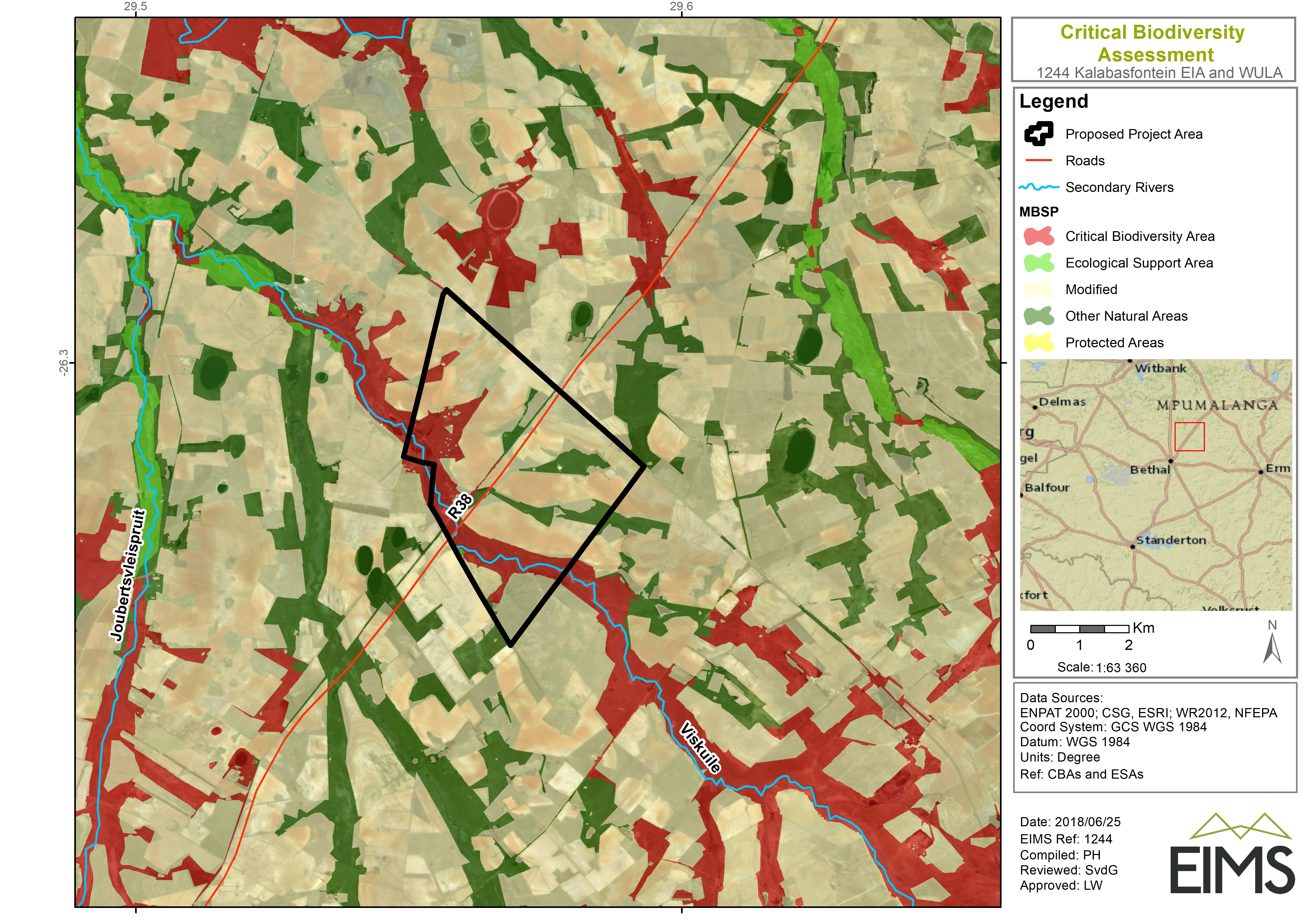
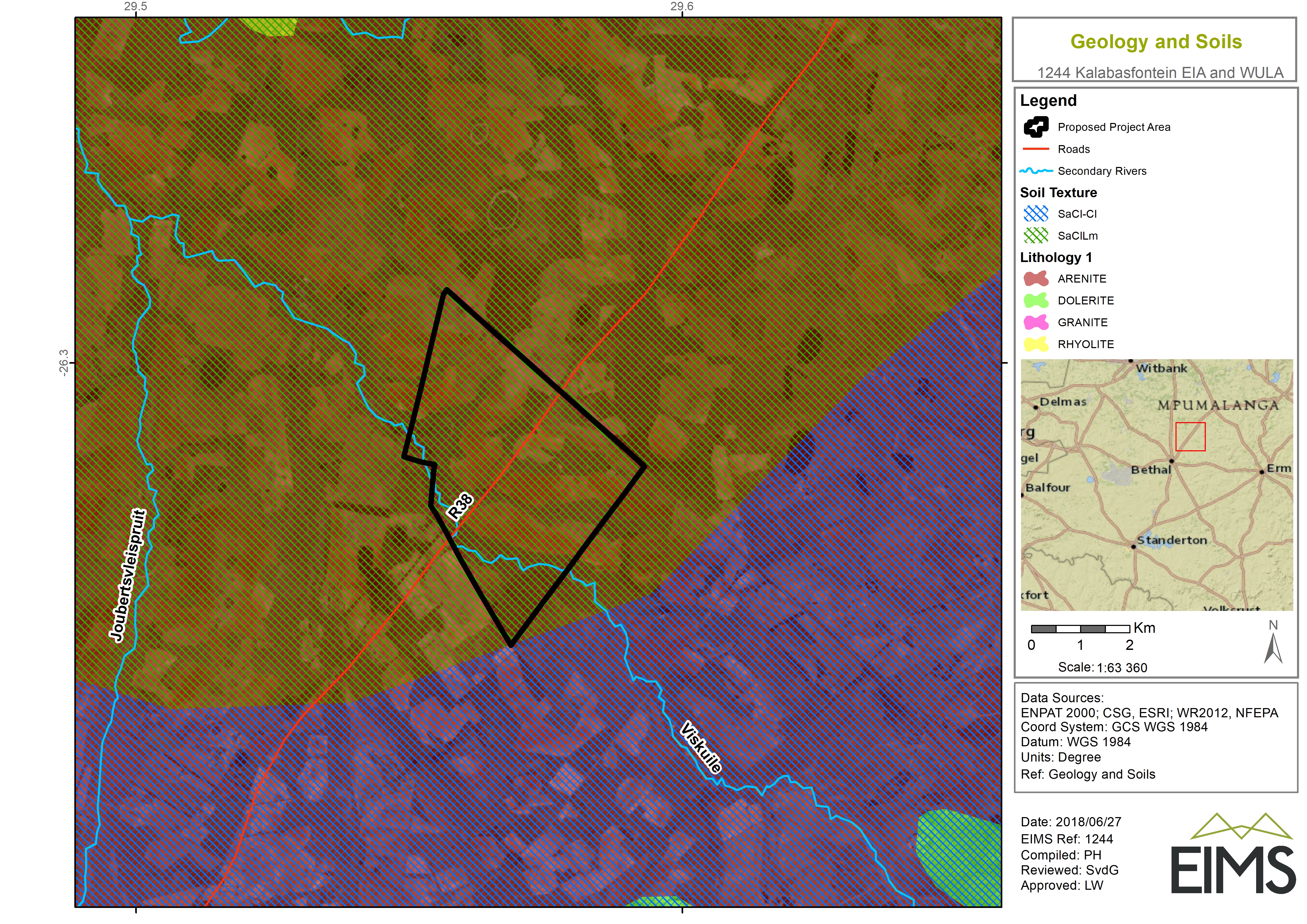
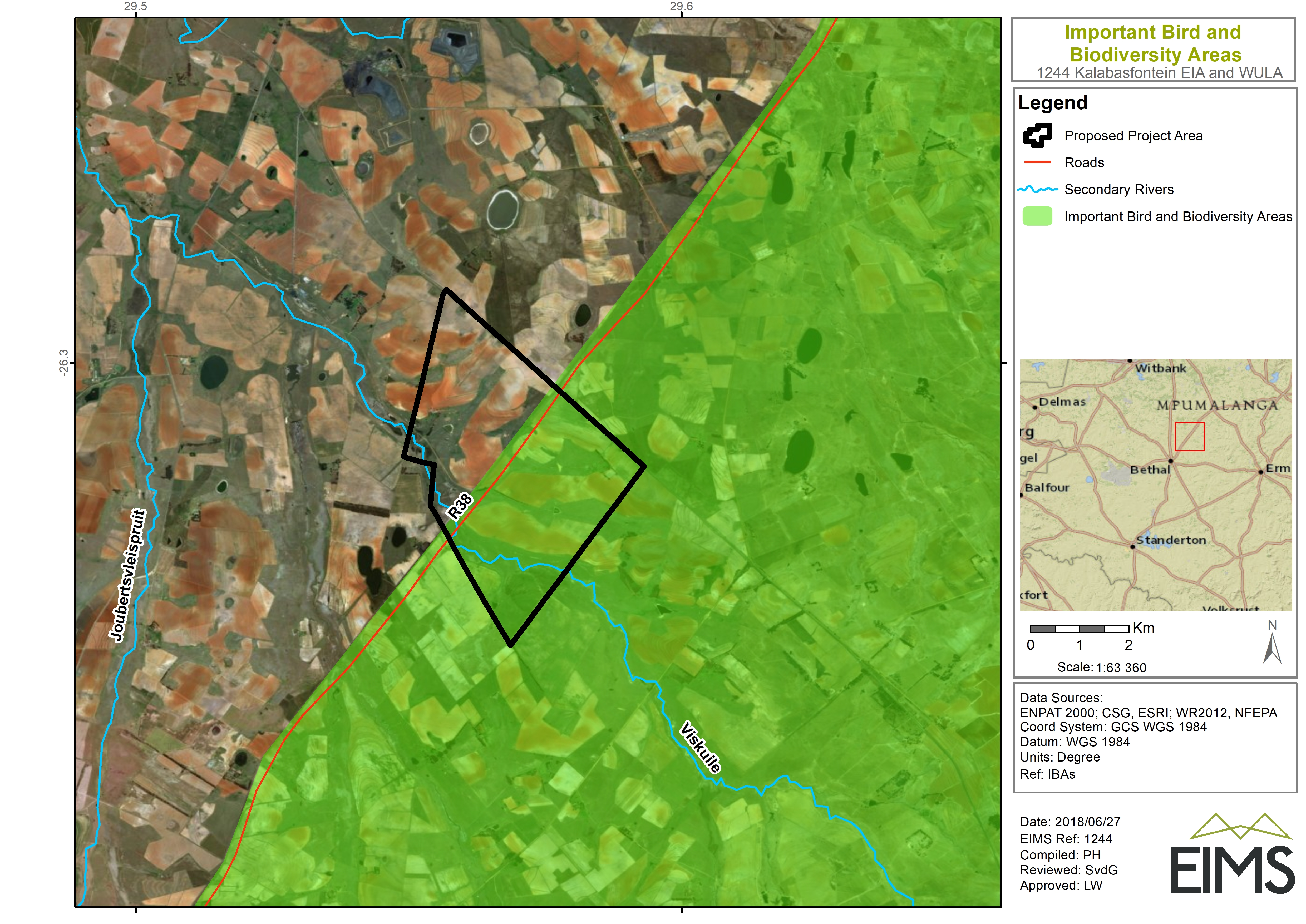
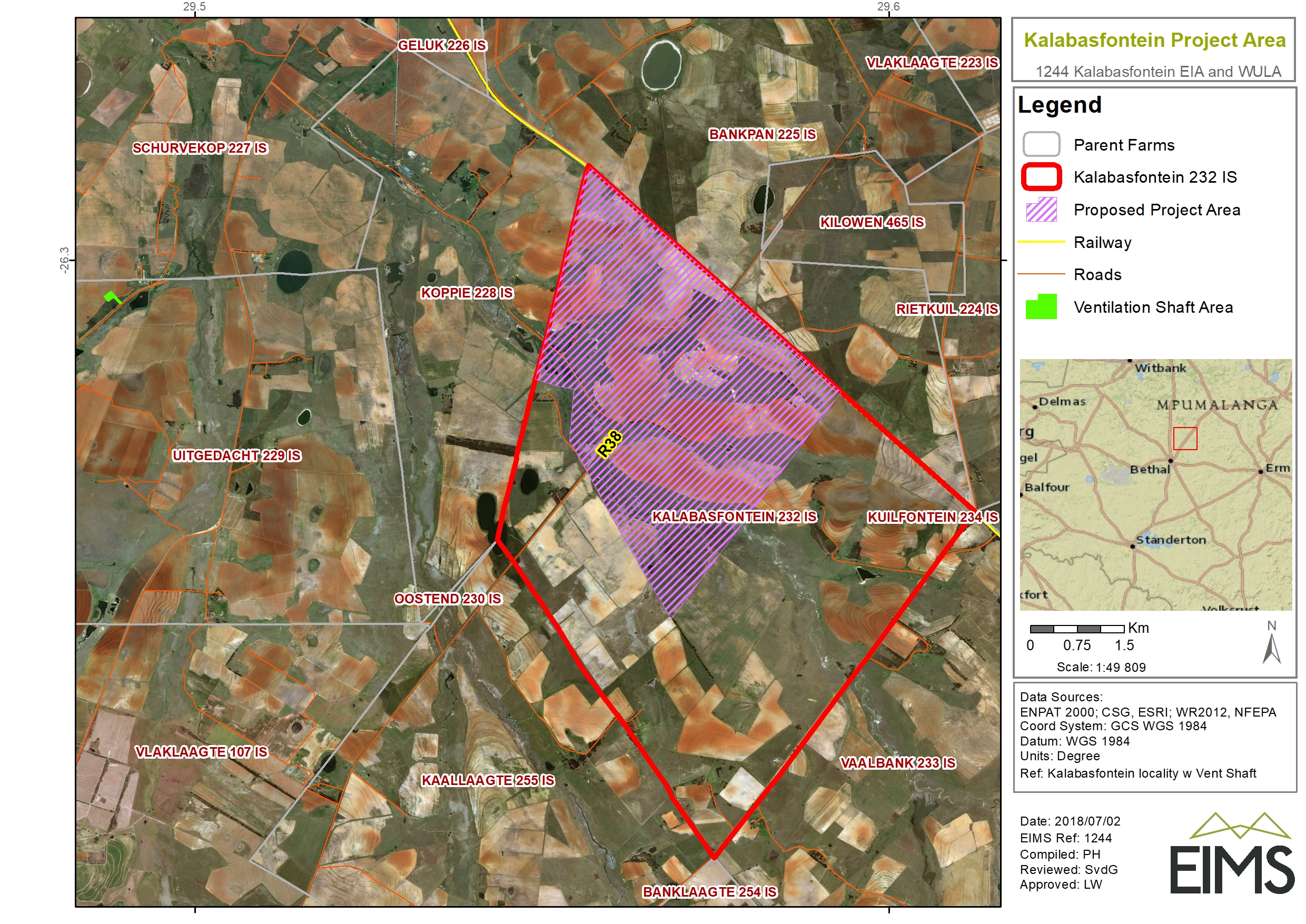
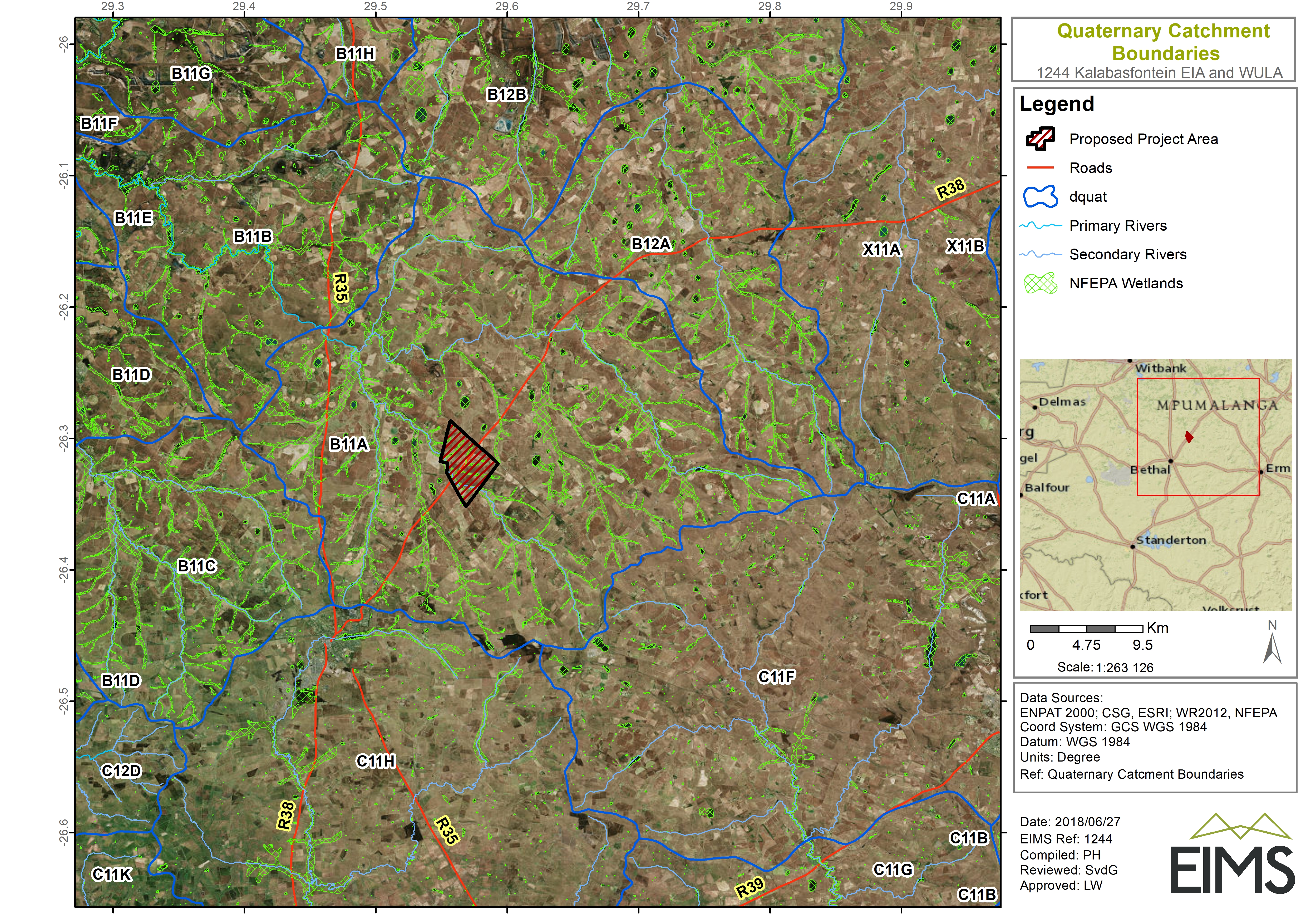
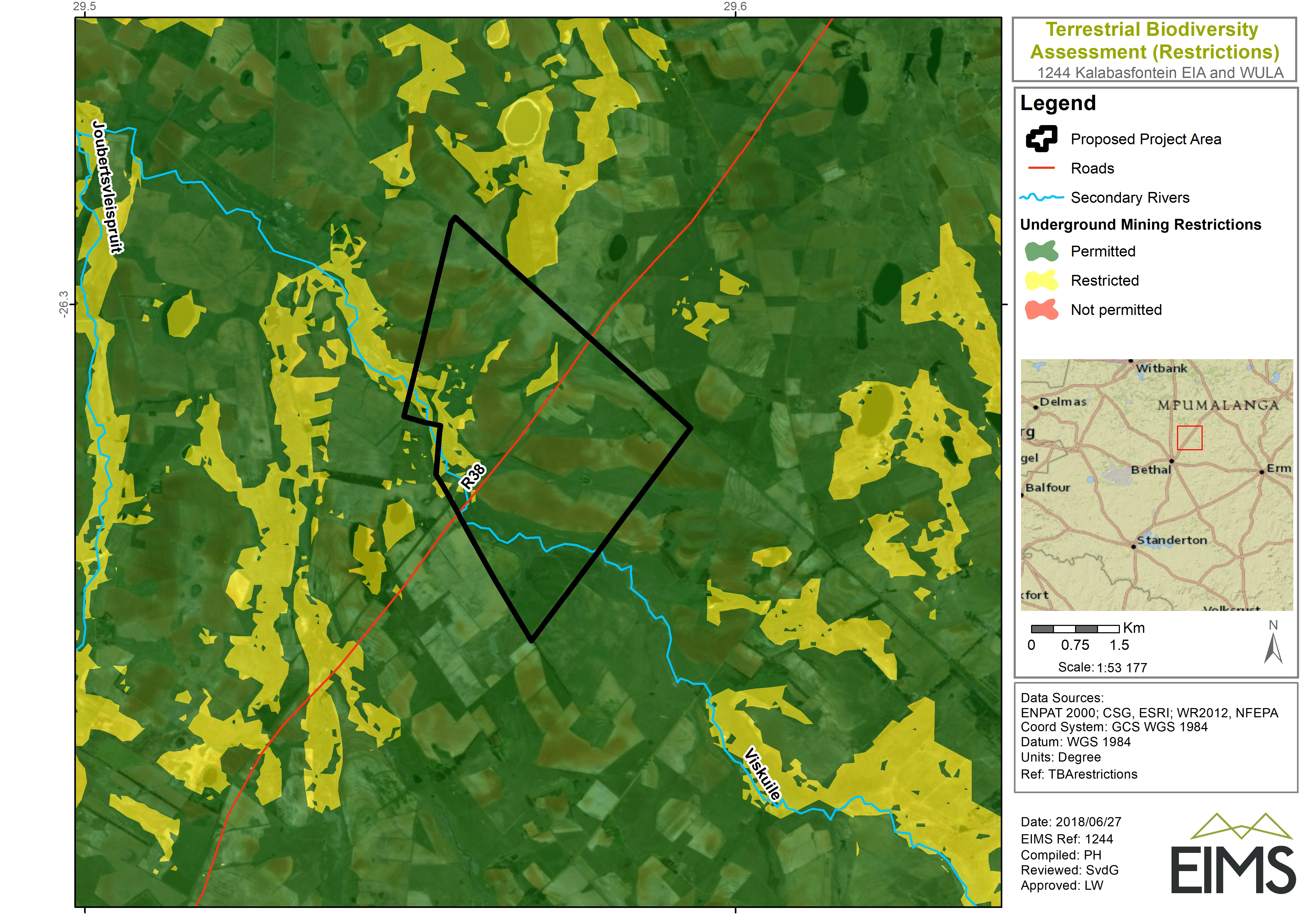
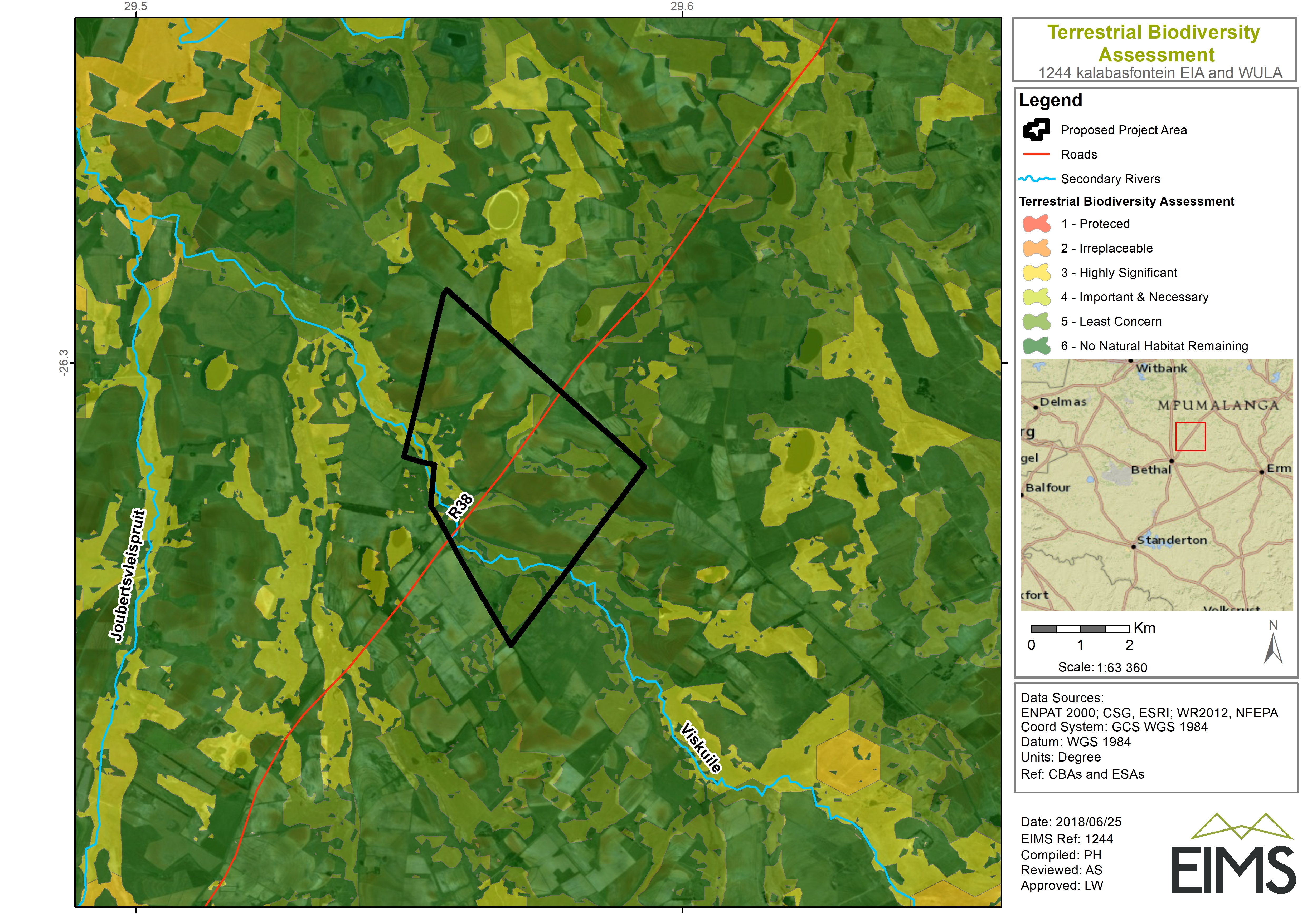
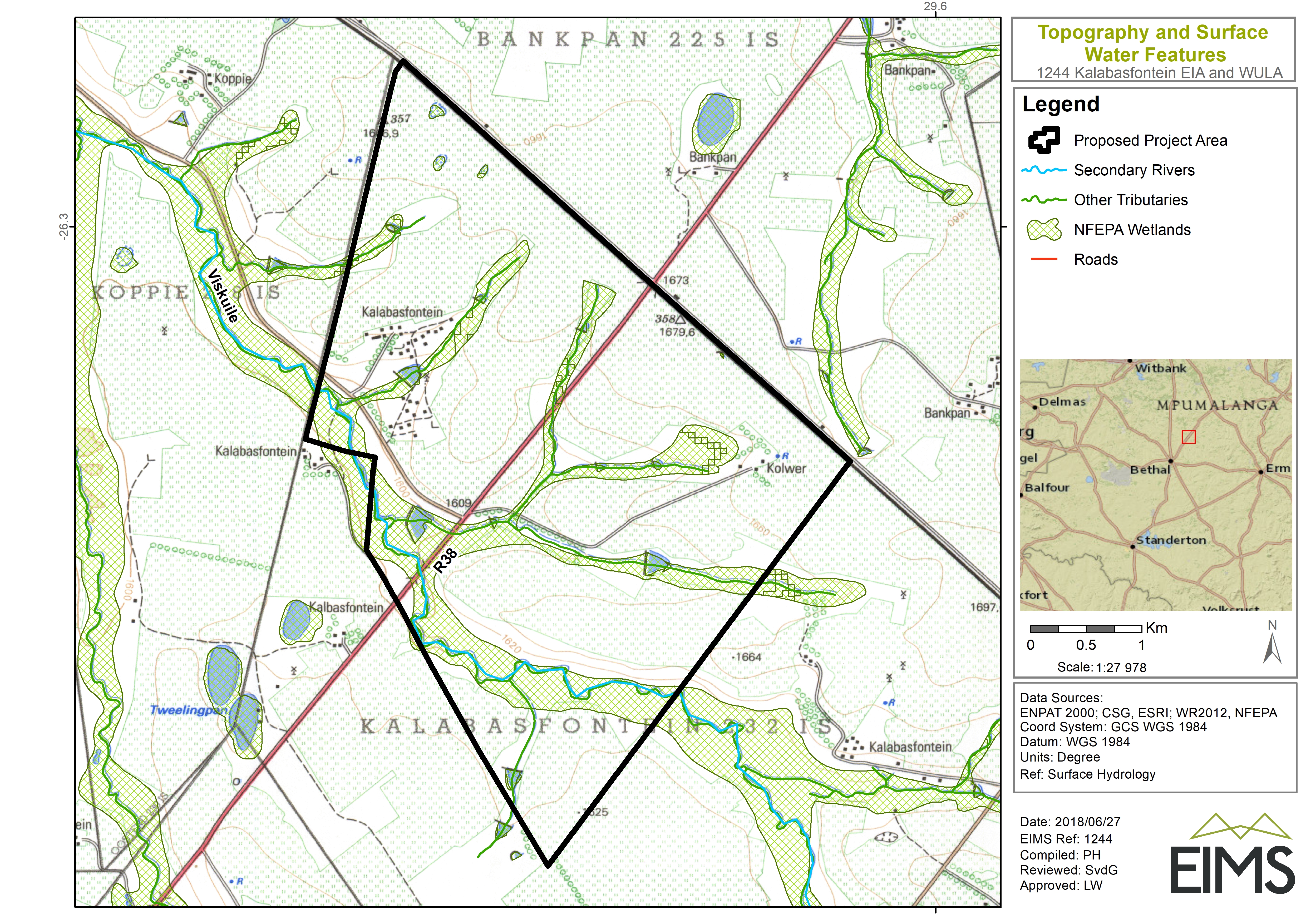
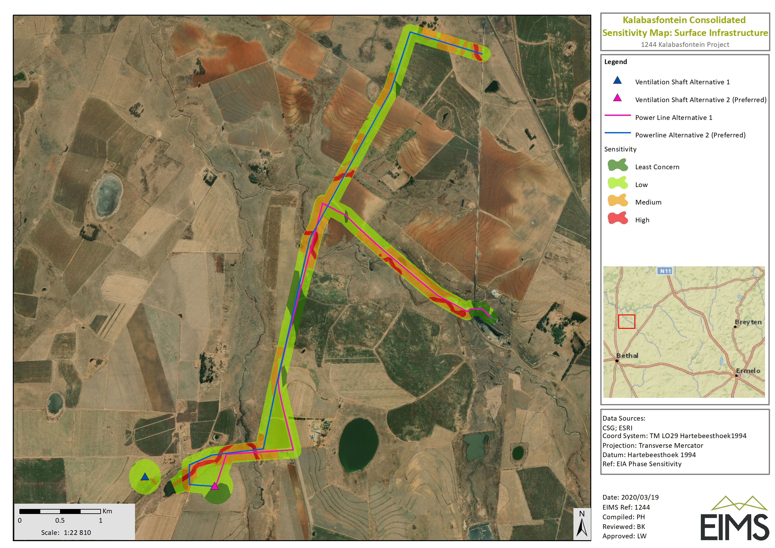
1244 Environmental Licencing Processes for the Kalabasfontein Project

CaseViews

CaseHeader

Status: 

HeritageAuthority(s): 

Development Type: 

ProposalDescription: 

Forzando Coal Mines (Pty) Ltd wishes to extend the current mining activities at Forzando South underground coal mines (under Mining Right MR380) by inclusion of contiguous areas which are held under Prospecting Rights 1035PR and 1170PR. The proposed extension does not intend to develop new surface infrastructure. There will be a need for two new ventilation shafts at the Forzando South mining area.

ApplicationDate: 

Thursday, June 21, 2018 - 07:54

CaseID: 

12615

OtherReferences: 

ReferenceList: 

AdditionalDocuments
  1. PDF icon 1244_BID Rev 1_180615_LIam.pdf
  2. PDF icon 1244_Notification Letter_20180618_CM_Combined.pdf
  3. PDF icon WBCV SonjavdGiessen_180626_Svdg.pdf
  4. PDF icon 1244_App 2d_Proof of Site Notice Distribution_20180625_CM (2).pdf
  5. PDF icon 1244_App 2e_Advert Tear Sheet_Highvelder_20180625_CM (1).pdf
  6. PDF icon 1244_App 2e_Advert Tear Sheet_Rideg Times_20180625_CM (2).pdf
  7. PDF icon 1244_ App 2f _Correspondence 1.pdf
  8. PDF icon 1244_ App 2f_Correspondence 2.pdf
  9. PDF icon 1244_App 2a_ Database.pdf
  10. PDF icon 1244_App 2b_ BID.pdf
  11. PDF icon 1244_App 2b_ Questionnaire (2).pdf
  12. PDF icon 1244_App 2bNotification Letter_20180618_.pdf
  13. PDF icon 1244_App 2c_Reg Mail and site notice distribution list.pdf
  14. PDF icon 1244_App 2d_Proof of Site Notice Distribution_20180625_CM (1).pdf
  15. File 1244_Public Participation Report_20180706_to print.docx
  16. PDF icon App 3 EA Signed applicant page.pdf
  17. PDF icon App 3 EA_Copy.pdf
  18. PDF icon App 4 Cumulative Impacts.pdf
  19. PDF icon App 4 Significance rating_Air quality.pdf
  20. PDF icon App 4_Significance rating_Ecology.pdf
  21. PDF icon App 4_Significance rating_Geohydrology.pdf
  22. PDF icon App 4_Significance rating_Geology and Soils.pdf
  23. PDF icon App 4_Significance rating_Heritage and Palaeo.pdf
  24. PDF icon App 4_Significance rating_Hydrology.pdf
  25. PDF icon App 4_Significance rating_Socio-economic.pdf
  26. PDF icon App 4_Significance rating_Visual Impacts.pdf
  27. Image icon App 5 CBAs and ESAs.jpg
  28. Image icon App 5 Consolidated sensitivities.jpg
  29. Image icon App 5 Geology and Soils.jpg
  30. Image icon App 5 IBAs.jpg
  31. Image icon App 5 Kalabasfontein locality w Vent Shaft.jpg
  32. Image icon App 5 Land Capability.jpg
  33. Image icon App 5 Land Cover.jpg
  34. Image icon App 5 Quaternary Catchment.jpg
  35. Image icon App 5 TBA restrictions.jpg
  36. Image icon App 5 TBA.jpg
  37. Image icon App 5 Topo & Surface Hydrology.jpg
  38. PDF icon 1244_Kalabasfontein Draft Scoping Report_180709_F.pdf
  39. File 1244_EIA Appendix cover pages.docx
  40. PDF icon APP1.PDF
  41. PDF icon APP4.pdf
  42. PDF icon APP5.pdf
  43. PDF icon APP6.pdf
  44. PDF icon APP7.pdf
  45. PDF icon APP8.pdf
  46. PDF icon APP9.pdf
  47. PDF icon APP10.pdf
  48. PDF icon APP11.pdf
  49. PDF icon APP12.pdf
  50. PDF icon APP13.pdf
  51. PDF icon APP14.pdf
  52. PDF icon APP15.pdf
  53. PDF icon APP16.pdf
  54. PDF icon APP17.pdf
  55. PDF icon APP18.pdf
  56. PDF icon APP19.pdf
  57. PDF icon APP20.pdf
  58. Image icon APP21.jpg
  59. PDF icon APP22.pdf
  60. PDF icon EIR.pdf


Search form